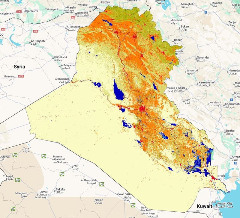
LandCover for 2020
Layer Description:
Raster map of land cover in Iraq for the year 2020 derived from the GLCLU v2 dataset. Provides the most recent snapshot of national land-cover conditions and is used in degradation and change assessments. (Legend included).
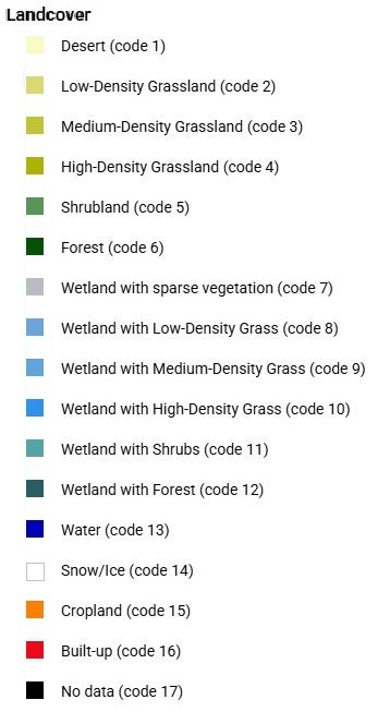
Legend:

Downloads:
Legend: Landcover Legend.jpg
Layer: LC 2020 (GEOTIFF).tiff