LandCover for 2015
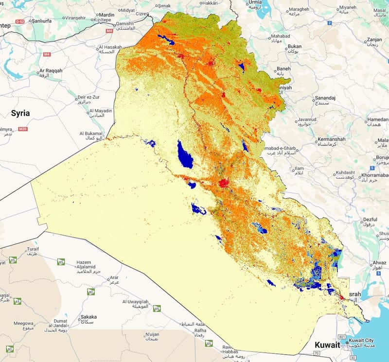
Layer Description:
Raster land-cover classification for 2015 across Iraq from GLCLU v2 data. Captures the extent of vegetation, bare land, water, built-up and other classes as a baseline for change analysis. (Legend file attached).
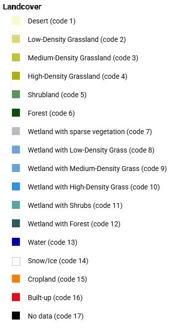
Legend: 
Downloads:
Legend: Landcover Legend.jpg
Layer: LC 2015 (GEOTIFF).tiff