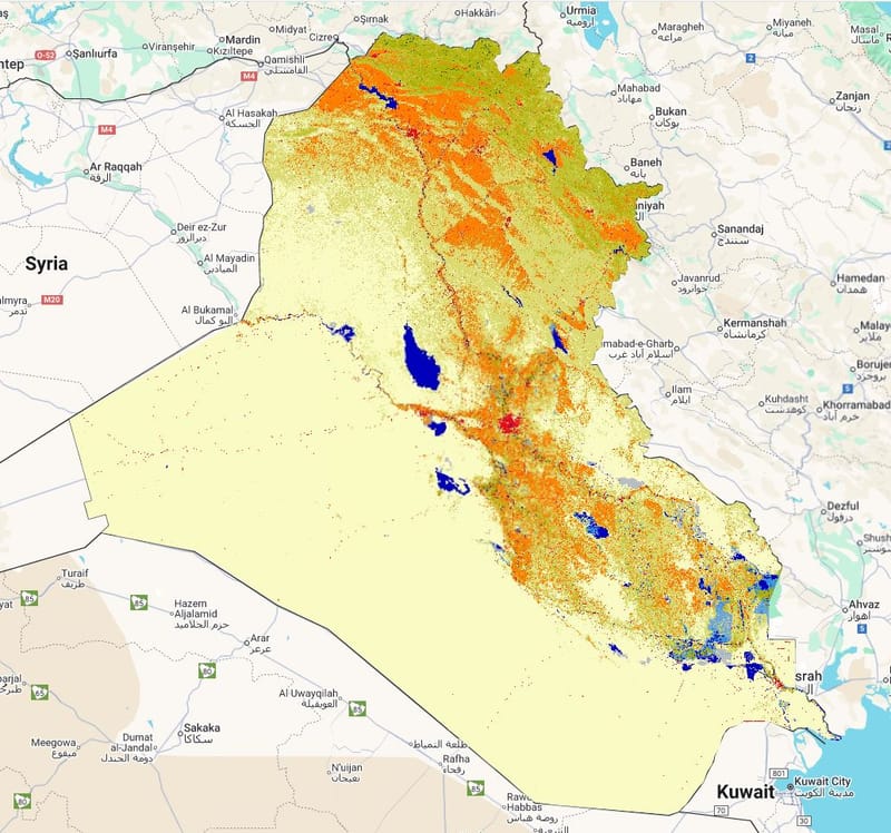
LandCover for 2010
Layer Description:
Raster map showing the spatial distribution of land-cover classes in Iraq for 2010, produced from the GLCLU v2 dataset. Used to compare changes in land cover over time when paired with other year maps. (Legend included).
Legend: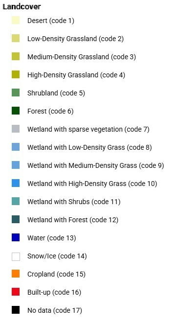
Downloads:
Legend: Landcover Legend.jpg
Layer: LC 2010 (GEOTIFF).tiff