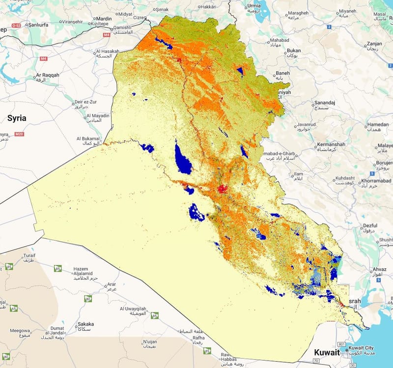
LandCover for 2005
Layer Description:
Raster map of land-cover classes in Iraq for the year 2005, based on the GLCLU v2 dataset. Represents major land cover categories across the country and supports analysis of land-cover status at five-year intervals. Includes associated legend.
Legend: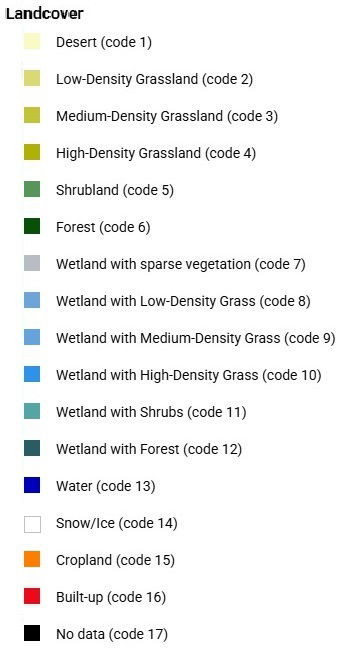
Download:
Legend: Landcover Legend.jpg
Layer: LC 2005 (GEOTIFF).tiff