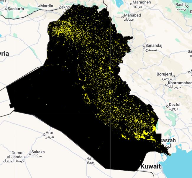
Landcover change (2000_2005)
Layer Description:
Raster dataset showing pixel-level transitions in land cover between 2000 and 2005. Each pixel value indicates a specific change class (e.g., desert → cropland), following the GLCLU v2 classification scheme. Legend file included.
Legend:
Downloads:
Legend: Landcover change Legend.jpg