Layer Description:
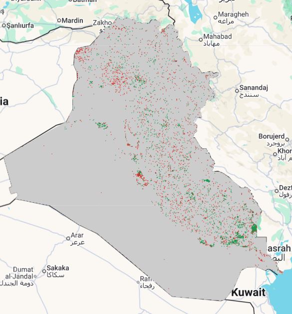
Raster layer of land-degradation status between 2005 and 2010, using UNCCD compliant rules applied to GLCLU v2 transitions. Pixel values map to degradation categories. Legend included.
Legend:
Download:
Degradation status 2005-2010 (GEOTIFF).tiff