Layer Description:
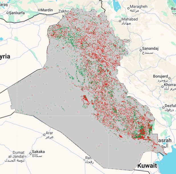
Two-decade degradation status raster (2000–2020), classifying land into stable, degraded or improved states based on observed land-cover change patterns. Legend provided.
Legend:
Download:
Degradation status 2000-2020 (GEOTIFF).tiff