Layer Description:
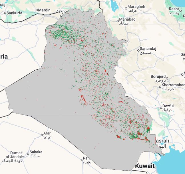
Raster classifying land-degradation status over 2000–2005 according to UNCCD SDG 15.3.1 methodology. Pixel values indicate “No Change”, “Degraded”, “Improved”, or “No Data” based on land-cover transitions. Legend file attached.
Legend:
Download:
Degradation status 2000-2005 (GEOTIFF).tiff